
PSSST. Jen made me promise never ever to tell anybody about Utah. They don’t want to share it with the typical US tourist. So if anybody asks you: it wasn’t me who told you.
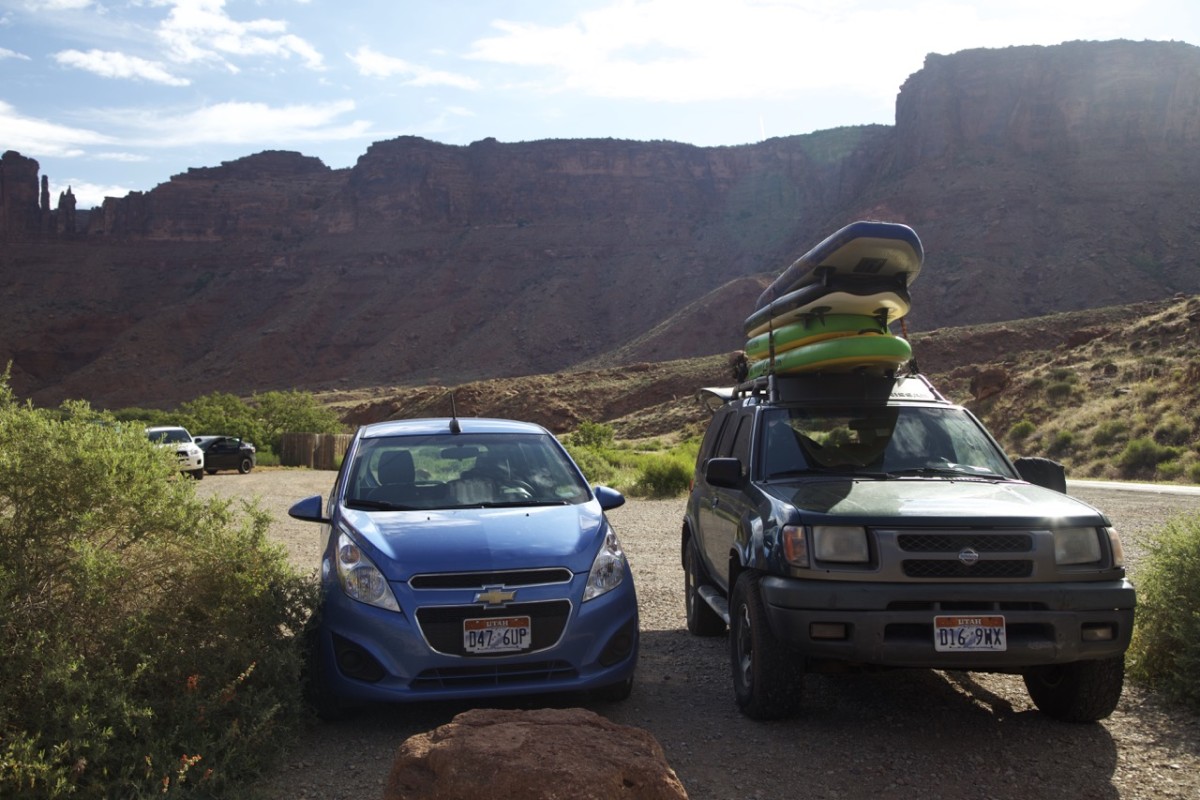
After consulting the lonely planet and talking to Jen and Santos it became clear that we wont be able to explore Utah without one of the most American cliches: our own car. So we rented the cheapest tiny car we could find for 330$ for two weeks. Far too small for the American standards it could anyway fit our backpacks a 6 gallon water jug (23l), a cooling box (many thanks to Jen and Santos) and food for several days. And off we went south.
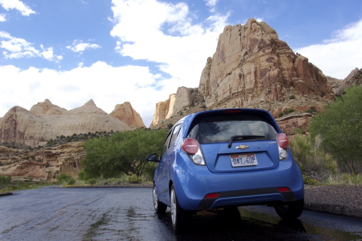
Just big enough for two germans and a sheep, but it’s off road abilities could be improved.
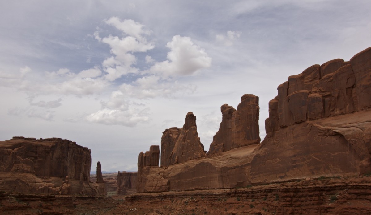
The first six days we spend near Moab (Utahs outdoor hub) and the Arches National Park. The area is almost exclusively shaped from water biting its way through red sandstone resulting in deep canyons carrying sand loaded water framed by red cliffs, caves supposedly containing a caveman, stretches of never ending red walls, and the so famous spikes and arches. One of them even being Utahs emblem. I think it’s not overstated to say that it’s a huge playground for grown up outdoories. There are lots of camping grounds, hiking, mountain biking, horseback riding, 4WD, and ATV trails, climbing routes, skydiving, motorboat driving, kayaking, stand up paddling and whatever else you can imagine doing outdoors (BBQing, beer drinking, recreating).
Red sandstone stretches as far as your vision allows to distinguish from red sanddunes.
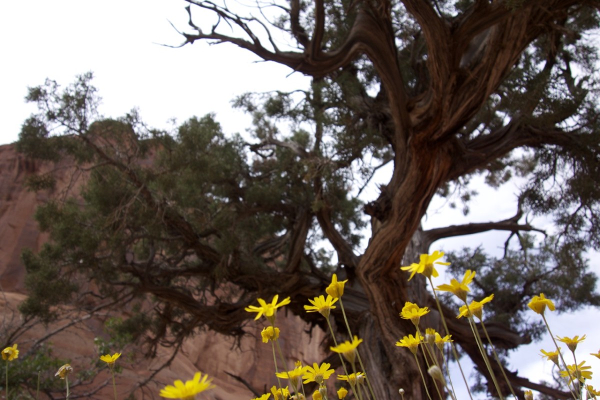
We visited south Utah in the beginning of May and found it to be surprisingly green and in this case yellow. Most of southern Utah is desert and only with a little luck and a wet spring you are able to see it flowering.
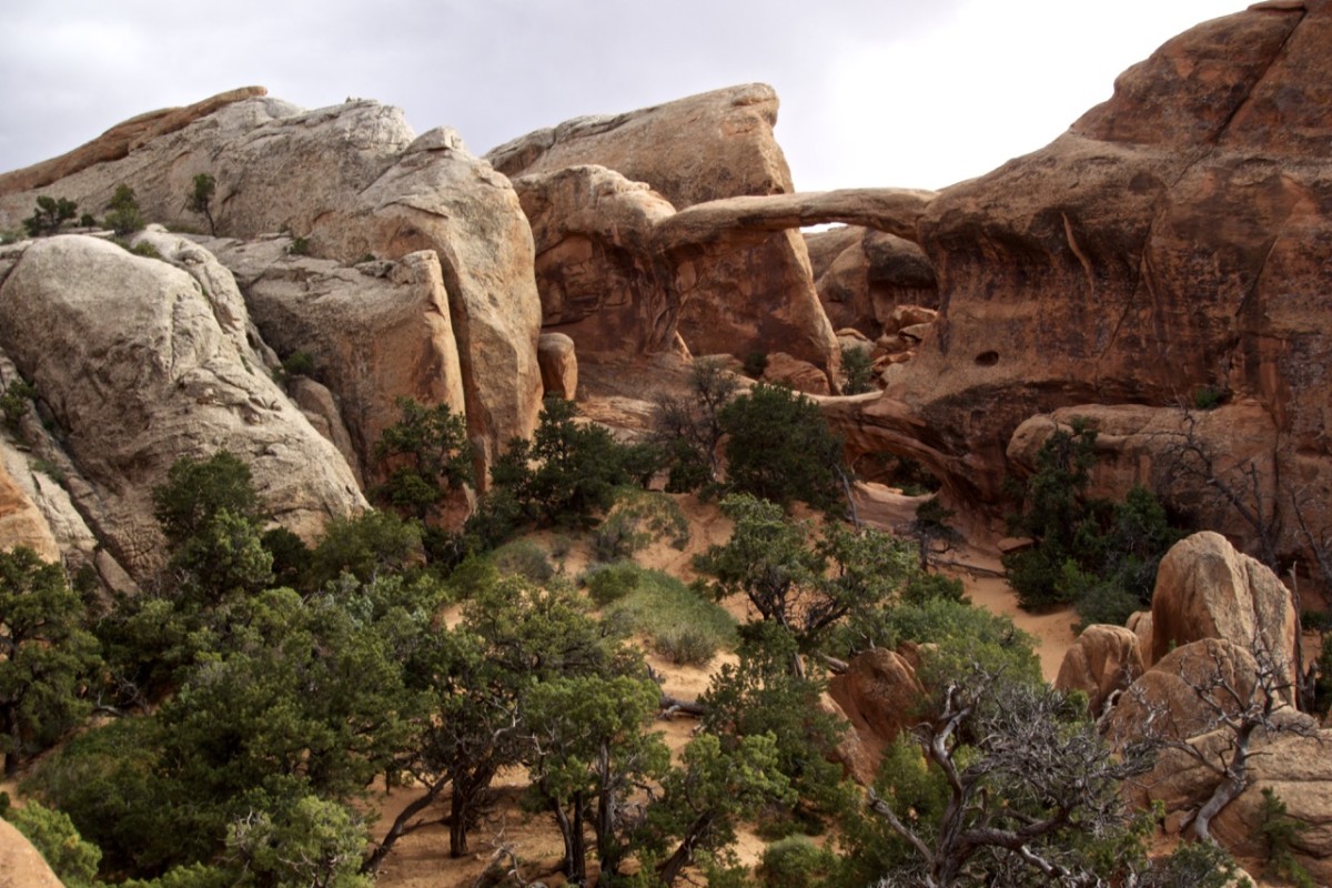
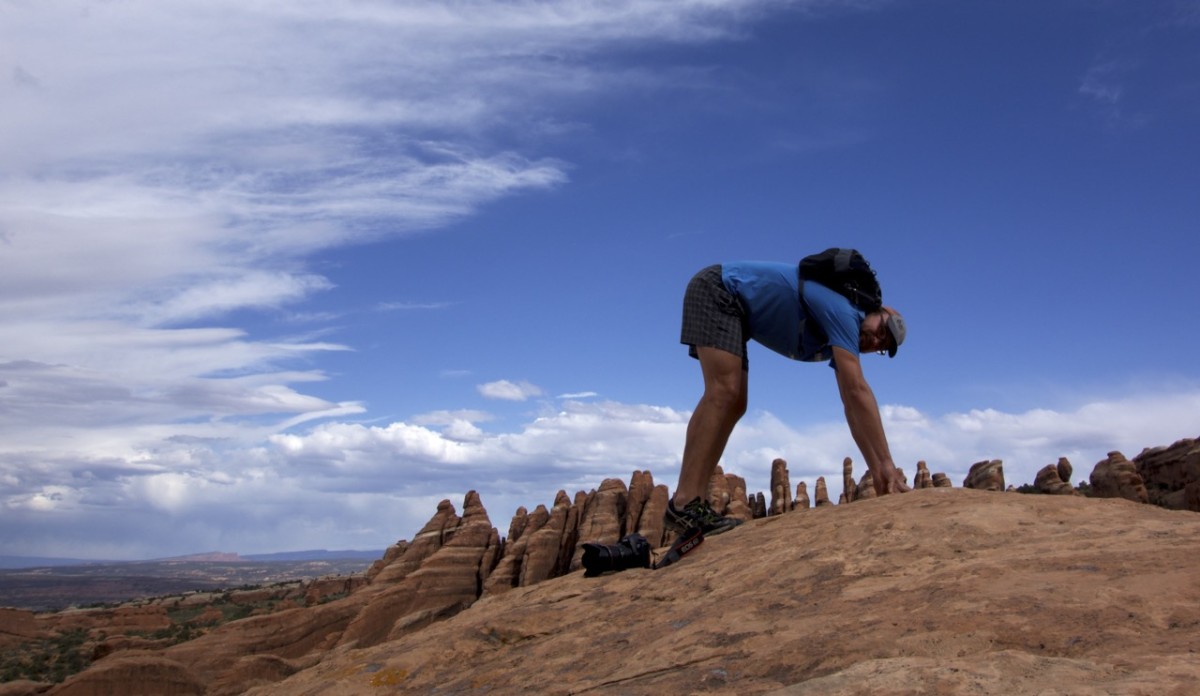
We spend two days hiking around holes in stones without having even seen 1% of the arches that are sprinkled over Arches National Park. Once an enormous field of sandstone was elevated and bend by an agglomeration of salt. Consequently the sandstone broke into slices which was the basis of forming arches by the continuous erosion by water and ice. It’s surely not the only place where you find natural arches but one with a pretty high density.
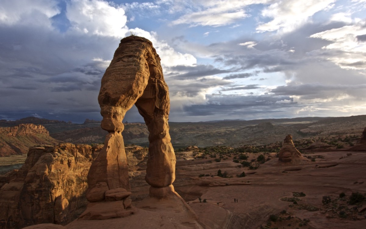
Delicate Arch – the most famous arch in the US and Utah’s emblem. Just between the two of us, this arch is so delicate that it need support from a metal frame, which can’t be seen from this perspective.
Double arch
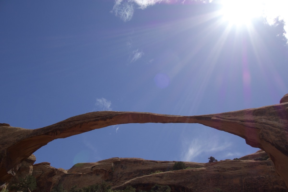
Landscape Arch
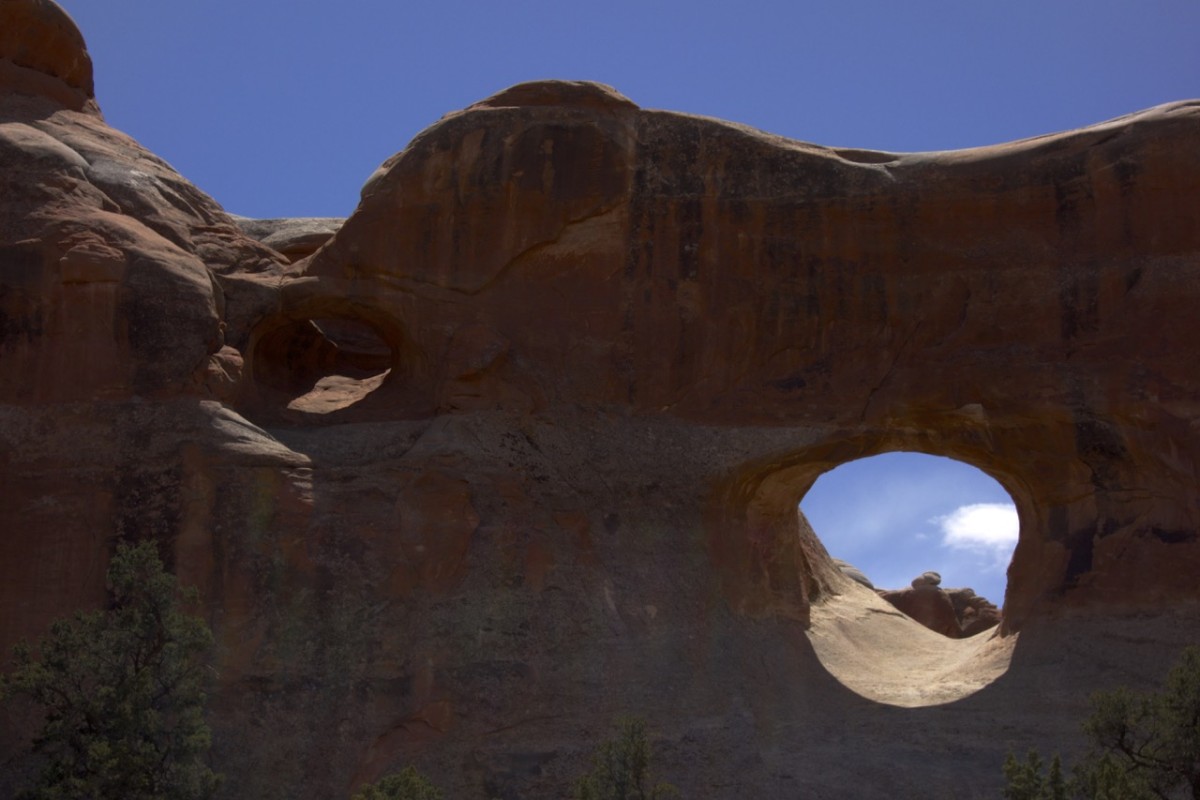
Double O Arch
Navajo Arch

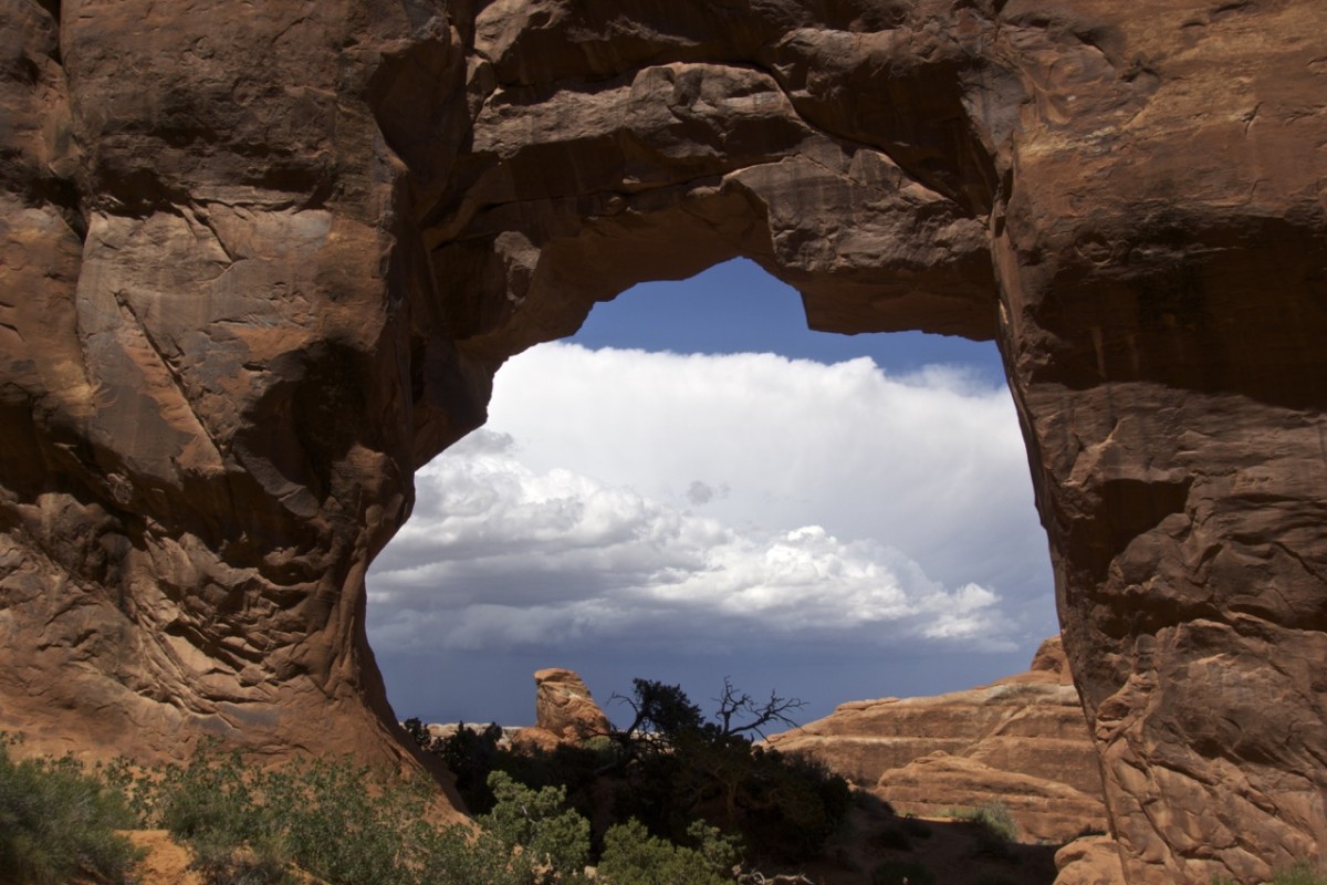
Partition Arch
Misused Arch – you are not allowed to walk over or even club an Arch.
As rough and hard as sandstone.
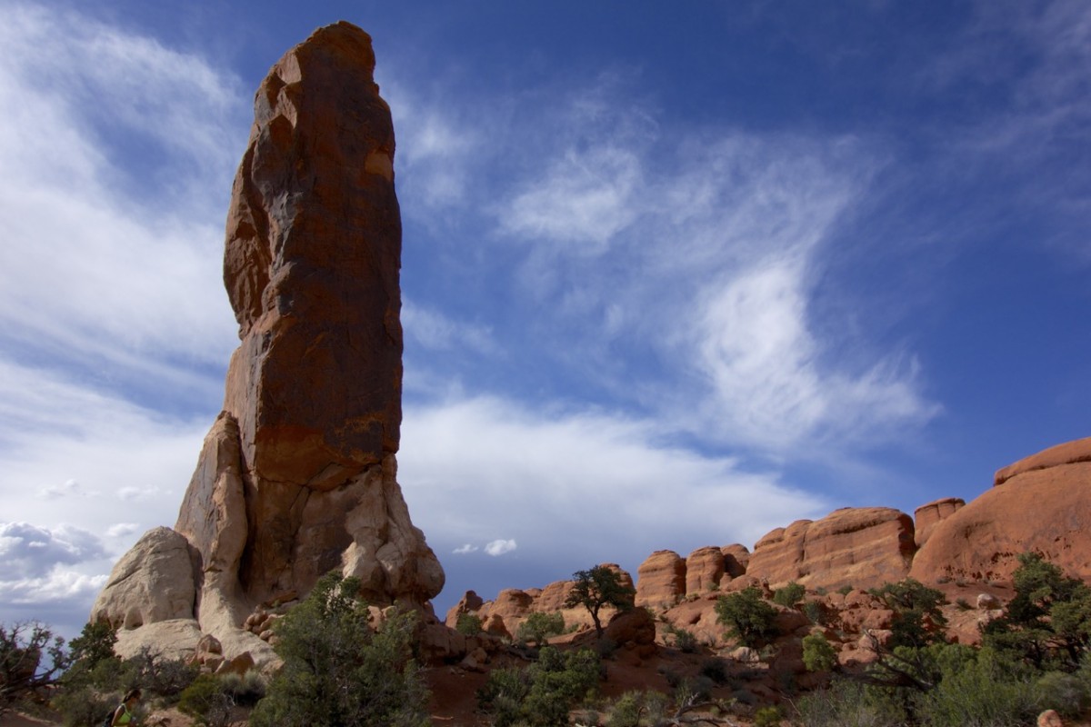
And of course where there are stones a phallus isn’t far (remember Chile?) even though they call this one the „black angel“.
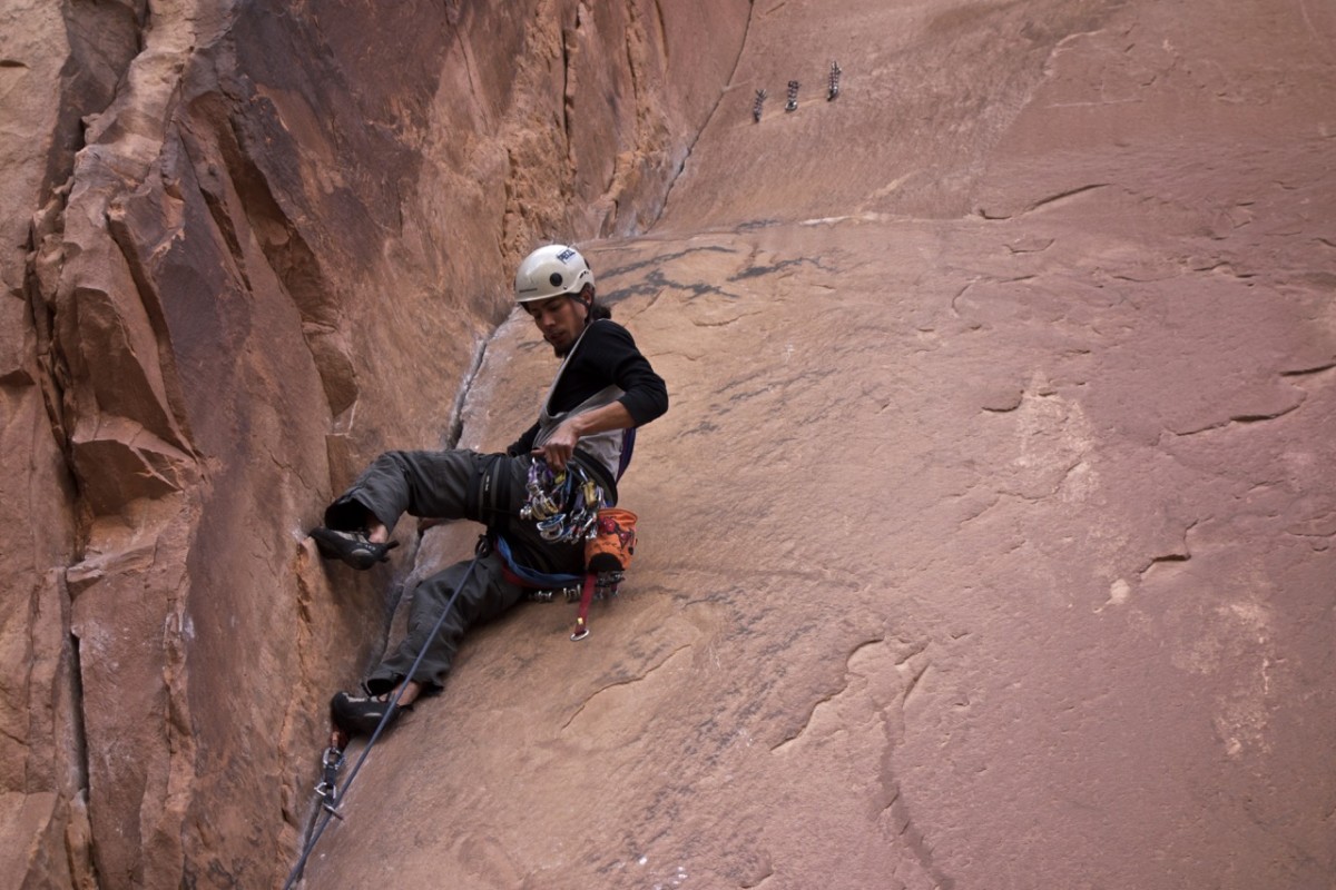
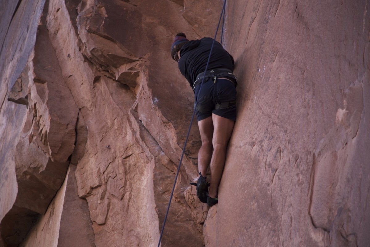
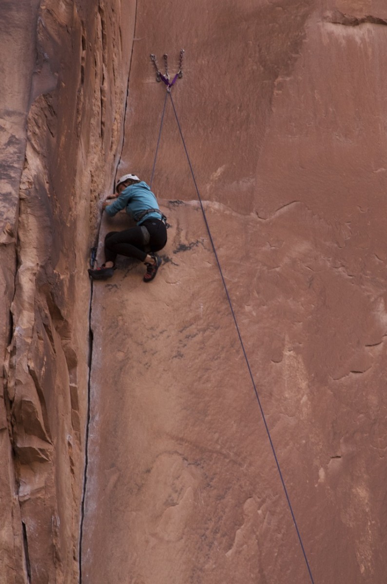
We were then joined by Santos and his friend who really put an effort into keeping our adrenalin level up. Santos a climber himself offered to do some climbs with us, which especially Tom accepted with great excitement. Something he always wanted to try. I willingly tried a climb at the so called Wallstreet (a road with a wall of red stone to one side).
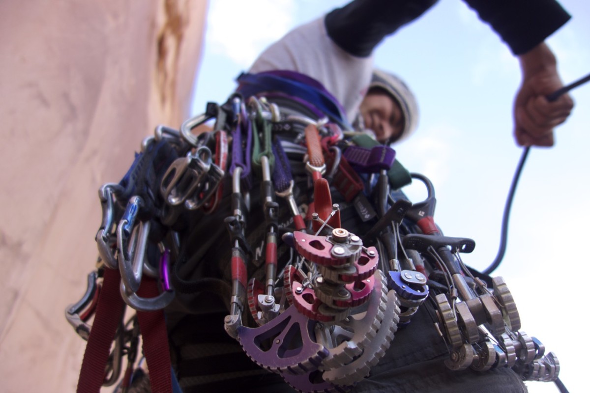
Just a little equipment for just a few meter up the wallstreet.
Looking pretty easy to climb a 2 cm broad slot, well?
Looking not quite …
… as graceful.
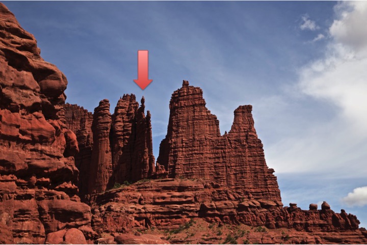
When I saw the goal of today it was pretty clear to me that I wouldn’t go up there.
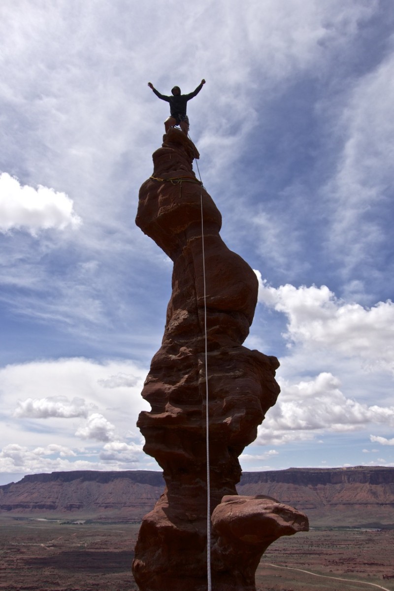
After about three hours Tom finally (though a little shaky) stand up on the Ancient Art.
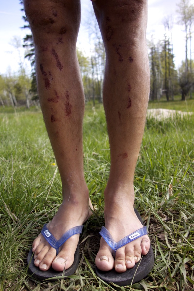
One day later. But who is climbing with shorts and a beanie?
On our last day with Santos „a half day“ iSUP (inflatable stand up paddling) trip on the Colorado river kept us busy the whole day (a friend of Santos owned the company organizing tours). These paddle boards are pretty stable but the water on Colorado river has somewhat white water so I ended up in the water 4 times (I estimate Tom went in at least 10 times). It was pretty fun, but next time I will bring a wet suit (I was wet to the bone and freezing in the shadow of the deep canyon). The two had to head home the same day and we headed for laundry before crawling exhausted into our sleeping bags.
iSUPs ready to go for the next day. When I was falling into the river after one minute on the iSUP, I was happy I didn’t brought any device to take pictures onto the river.
Distances get a different dimension in this vast country.
What ever we did, I got the impression all dimensions are scaled by a factor of ten in the US.
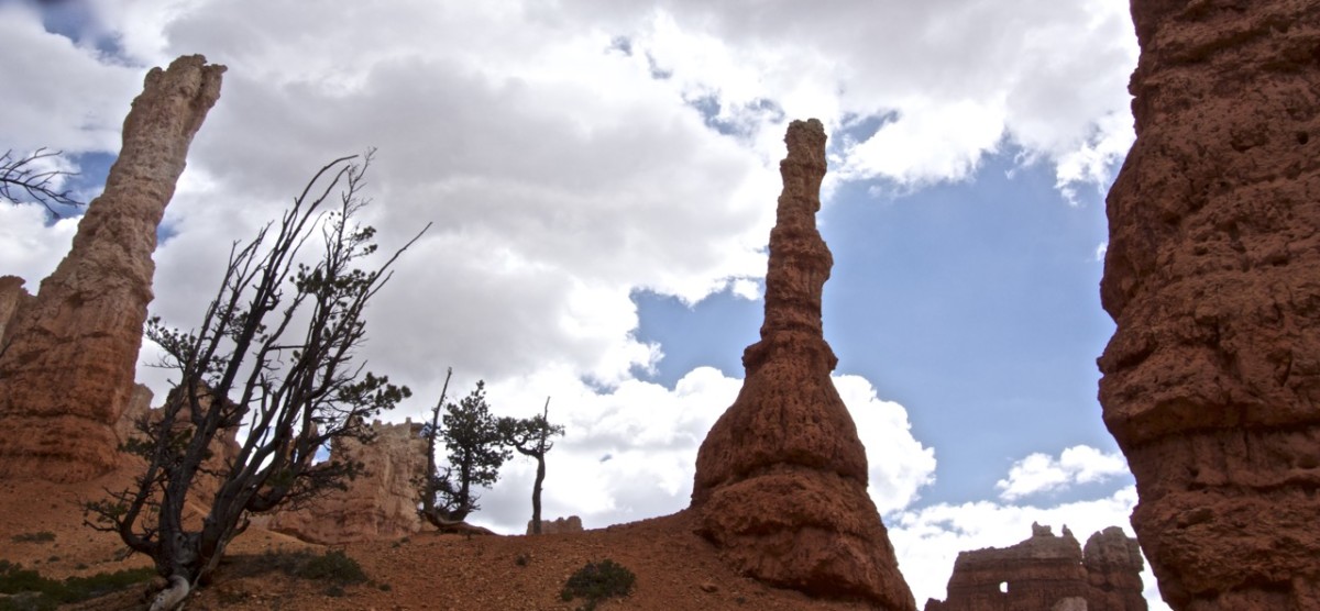
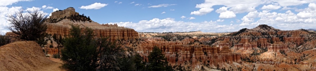
Solo standing hoodoo’s were the exception in Bryce national park.
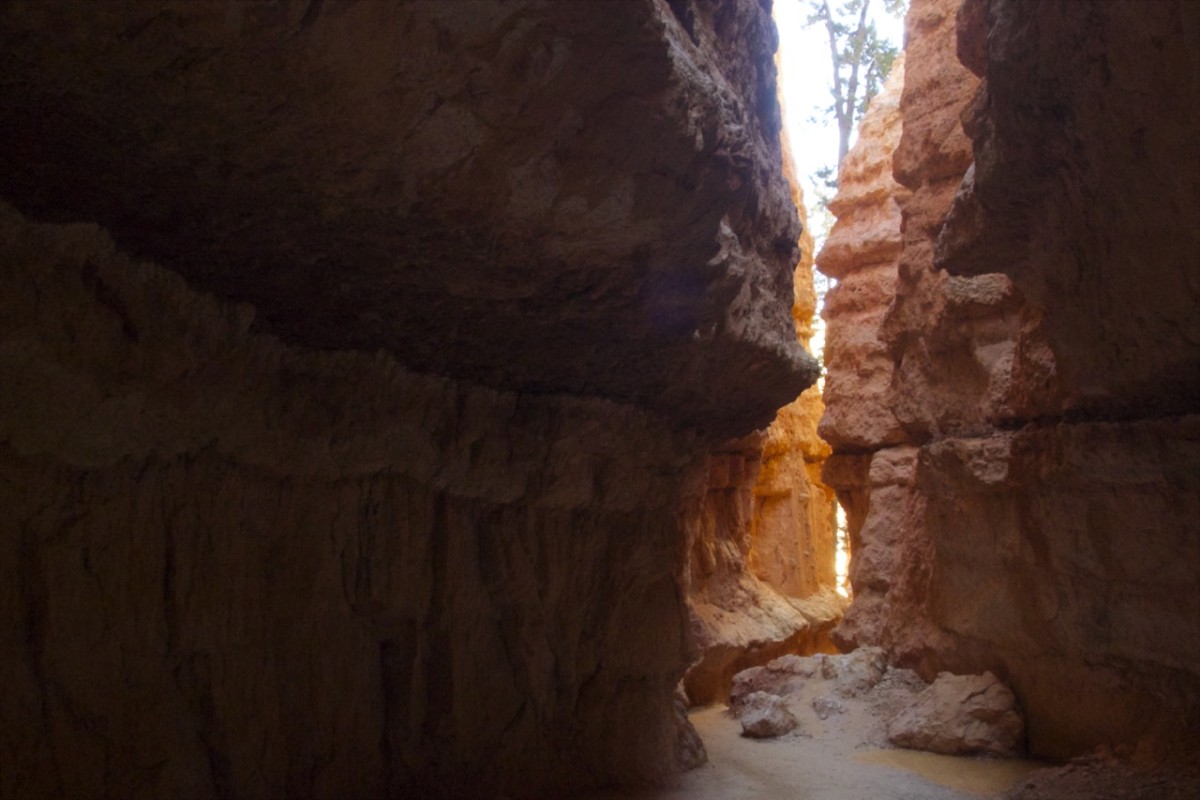
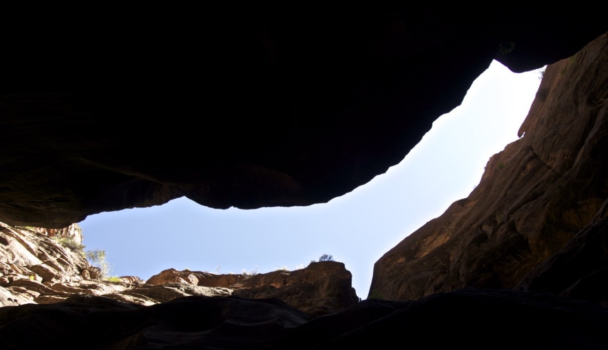
Erosions reach sometimes so deep, that we already visited the second „Wallstreet“ in the US without having been to NewYork City.
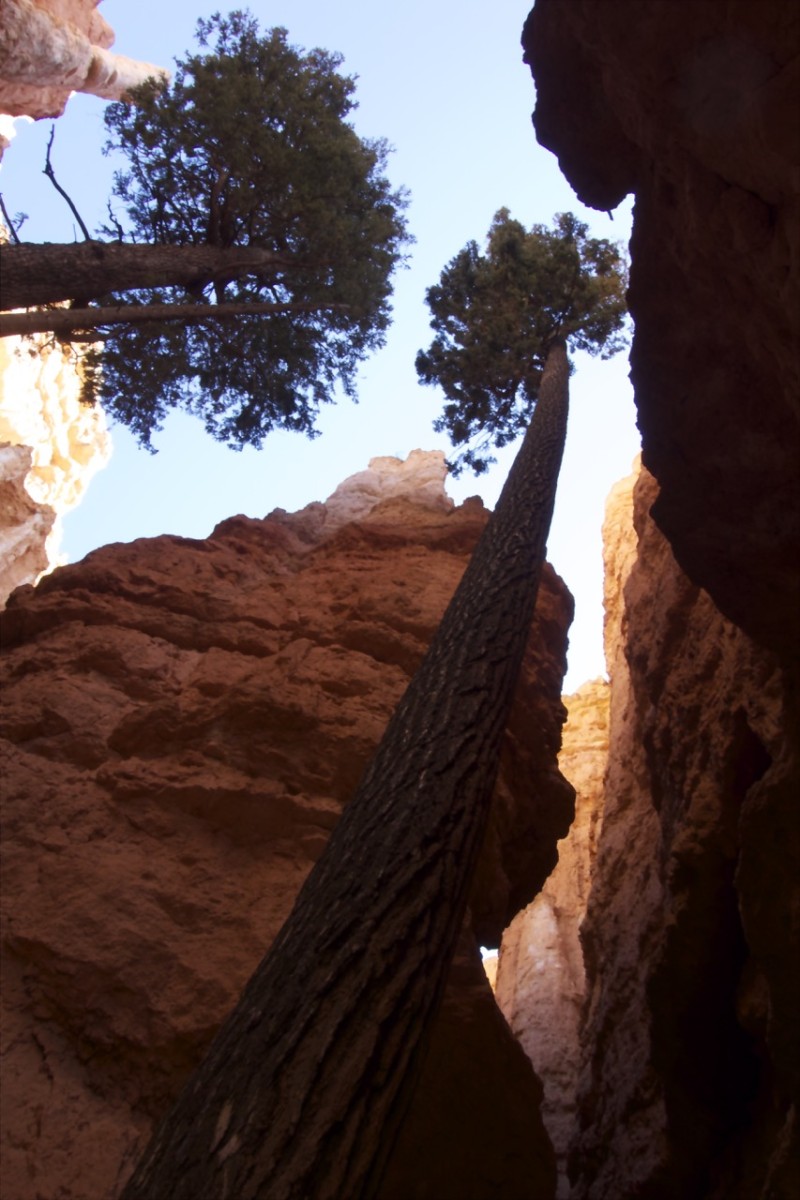
And well, if stone reaches deep dimensions tree simply counter act.

For a long time, this was our first hiking trip without cold feet.
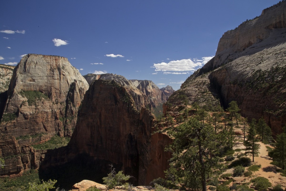
I wasn’t really aware of what I was buying into, when I agreed to climb up Angels landing.
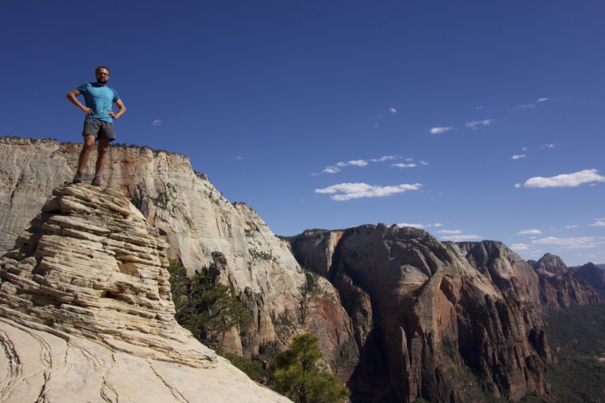
Tom climbing a bit higher than his guardian can fly (my opinion).
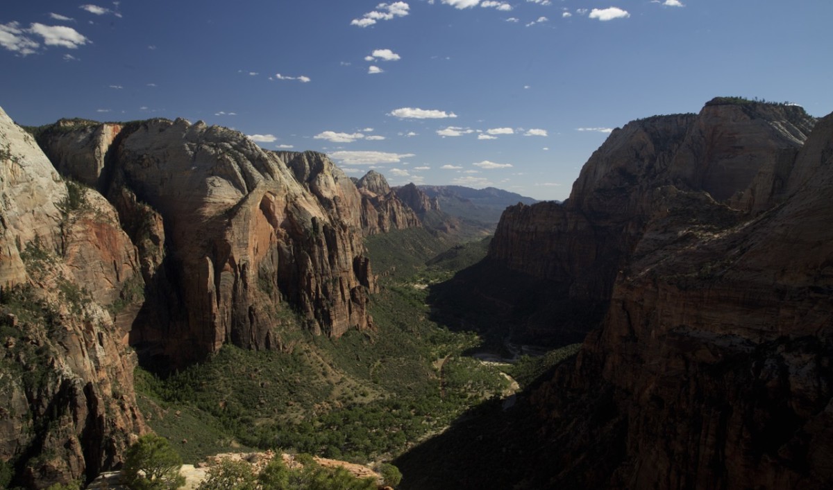
The view into Zion Canyon is most impressive at sunrise or sunset (as usual). By the way according to the Mormons „Zion“ in general names a place where the righteous can escape all badness of this world. Well. They not just renamed this Place that was inhabited since thousands of years by native americans, but simultaneously gave all peaks names of mormon saints.
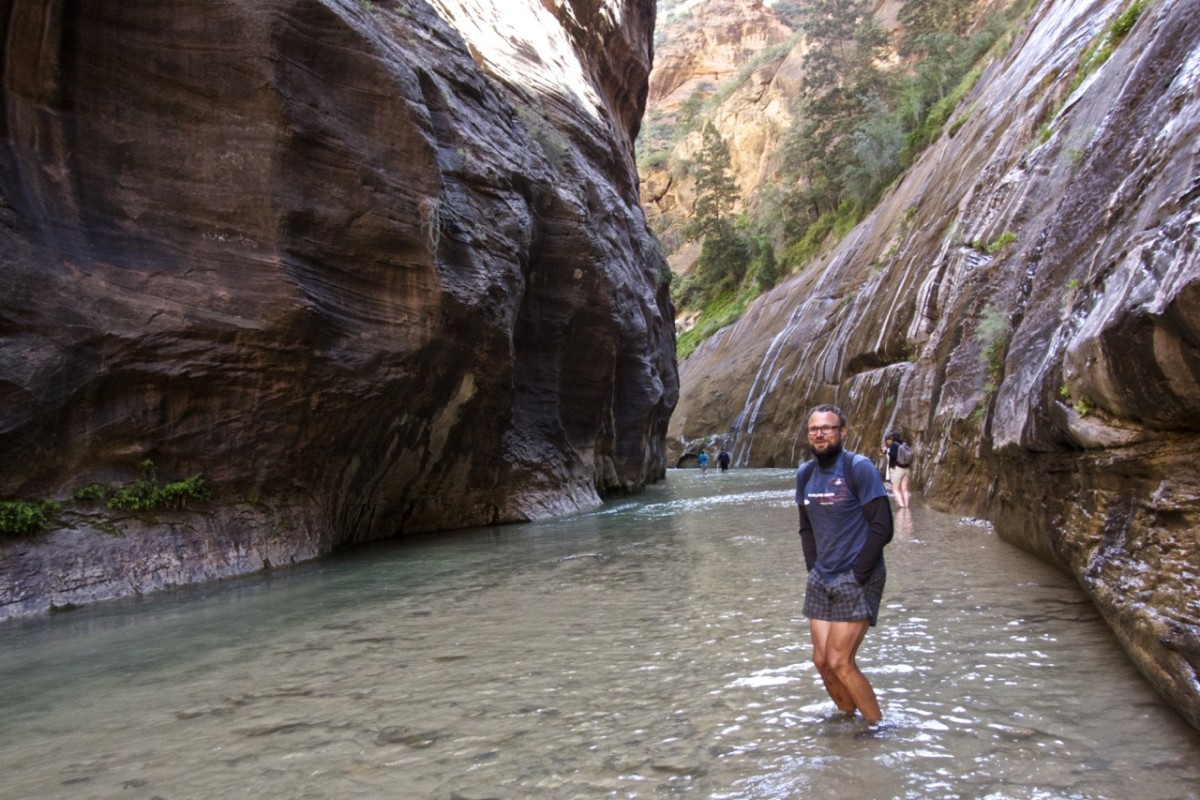
Every kind of human excretion has to be buried 100 feet from any water source. not easy to find a spot in a place like this.
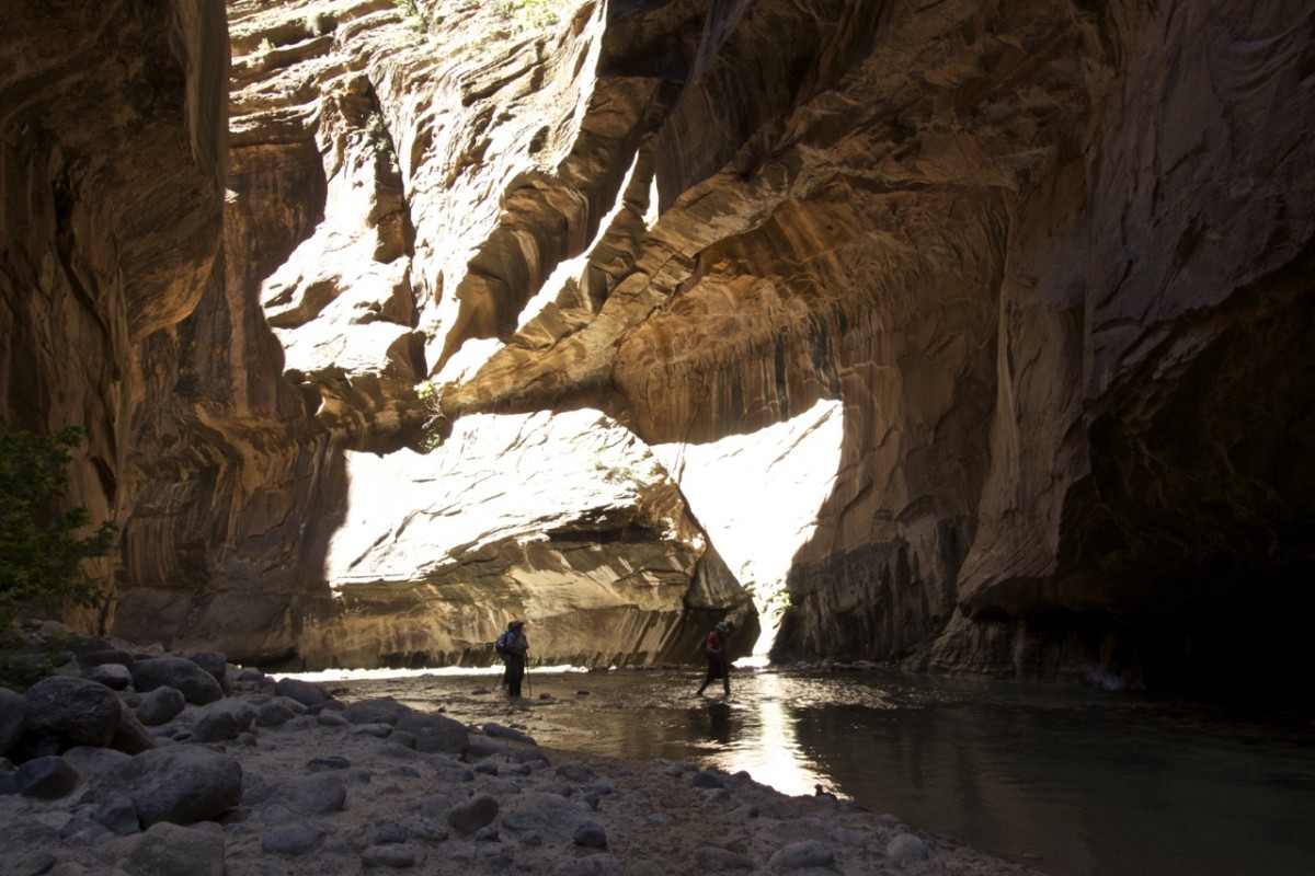
But it’s such an incredible place to hike. And if you are uncomfortable it is possible to rent water tight shoes in the visitor center.
If there is any kind of rain forecasted DON’T go in here. There is absolutely no escape in case of a flash flood.